
黄山市地图Map of Huangshan City
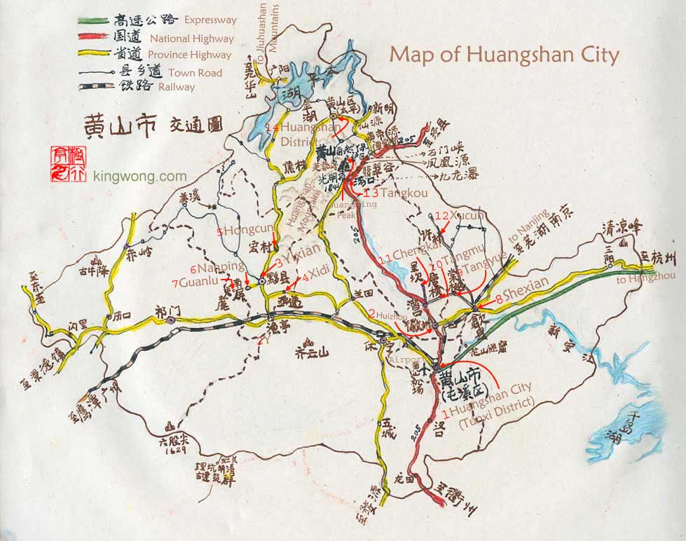
- 1. 黄山市(屯溪区)Huangshan city (Tunxi District)
- 2. 黟县Yixian county
- 3. 徽州Huizhou
- 4. 西递Xidi village
- 5. 宏村Hongcun village
- 6. 南屏Nanping village
- 7. 关麓 Guanlu village
- 8. 歙县Shexian county
- 9. 棠越Tangyue village
- 10. 唐模Tangmu village
- 11. 呈坎Chengkan village
- 12. 许村Xucun village
- 13. 汤口Tangkou
- 14. 黄山区(太平)Huangshan District (Taiping)
黄山市地图Diagram of Huangshan area
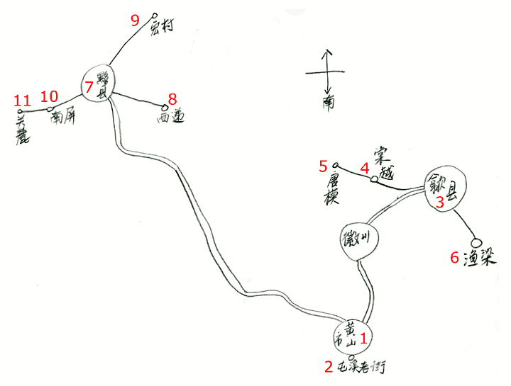
- 1. 黄山市Huangshan city - 屯溪区 Tunxi District
- 2. 屯溪老街The old town in Tunxi district
- 3. 歙县Shexian county
- 4. 棠越Tangyue village
- 5. 唐模Tangmu village
- 6. 渔梁Yuliang - The old town of Shexian county
- 7. 黟县Yixian county
- 8. 西递Xidi village
- 9. 宏村Hongcun village
- 10. 南屏Nanping village
- 11. 关麓 Guanlu village
宏村的地形,街路,水圳湖河Map of Hongcun's landscape with its roads, lanes, canals, lakes and rivers
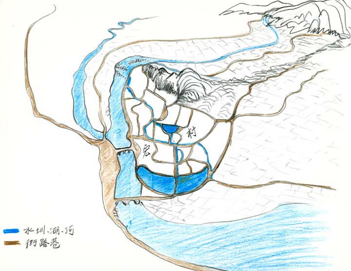
The blue color lines and shapes are canals, lakes, and streams. The light-brown ones are the alleys, lanes, and roads. Between the network of lanes are the buildings.
宏村的地形和水圳Map of Hongcun's waterways
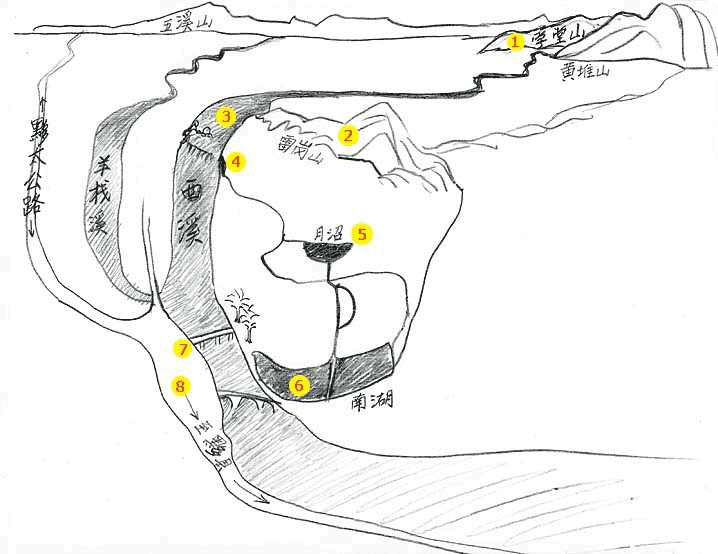
- 1. 学堂山Xuetangshan
- 15 kilometer from Hongcun is this mountain which supplies the water for the 西溪Xixihe stream.
- 2. 雷岗山Legangshan
- The legendary hill of the village.
- 3. 西溪Xixi(West Stream)
- The stream that is the source of water for the waterways of Hongcun. Show here are the main canals. Smaller canals cover more areas. Together all the entire network goes to 57% of all households, or 218 households. By adding the two lakes, 83% of all households get direct water.
- 4. 水圳进水口- The starting location of the water entering the village.
- 5. 月沼Yuezhao (Crescent lake).
The half-moon shaped lake in the center of the old village. It has a surface area of 1206.5 meters, a length of 137 meters and is a depth of 1.2 meter.
- 6. 南湖Nanhu (South Lake).
The stomach-shaped lake on the southern end of the village. It has a surface area of 20,247 meters, a length of 833 meters and a depth of 1.5 - 1.8 meters. In the middle of the lake and running along a north/south axis is a causeway with a single-arched stone bridge, 画桥Picture Bridge, almost midway on its path.
- 7. 村口
Main entrance to Hongcun. Across the stone bridge is a small square flanked by two large old trees.
- 8. 至黟县
Going south is the direction toward Yixian county. Buses from Yixian will stop on the station not far south of the bridge. On the left side of the road is the 际村Jicun village.